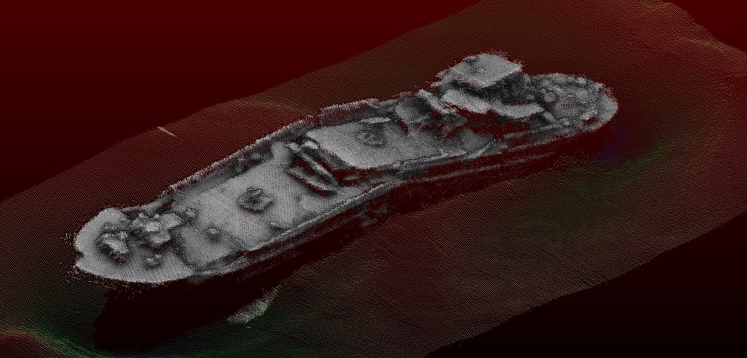
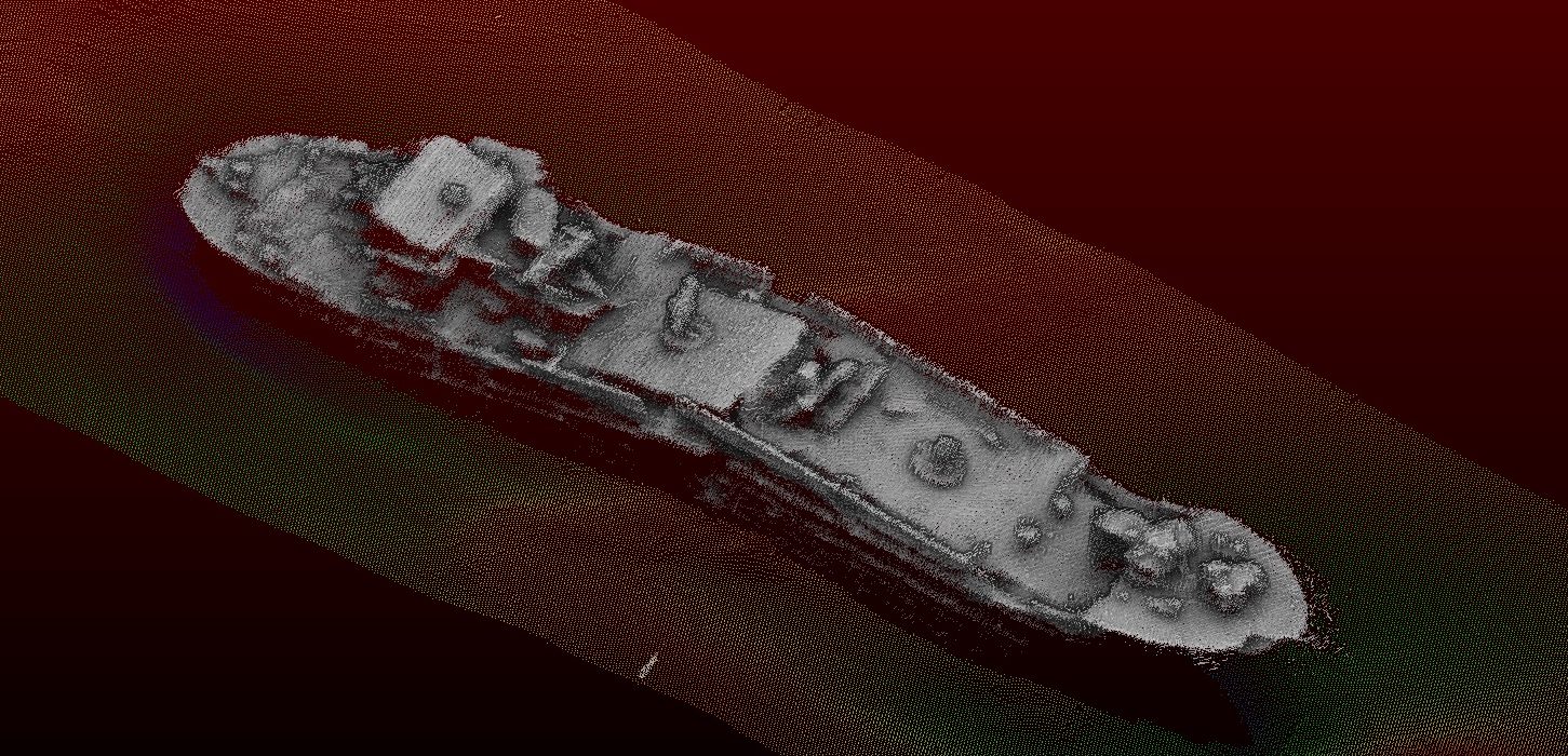
In the Netherlands, there are numerous shipwrecks lying at the bottom of the North Sea, the Wadden Sea and the IJsselmeer. Usually these wrecks have been identified and registered in the ‘Archis’ database of the Cultural Heritage Agency (RCE). However, a certain wreck may sometimes prove interesting. In 1989, for example, the Directorate-General for Public Works and Water Management performed a side scan of what was then an unknown wreck in the Eastern Scheldt.
In 2009 and 2019, Wrakduikstichting de Roompot (WDSR) and several other foundations and work groups explored the wreck off the Roompot Marina harbour. Intensive diving and archive exploration resulted in an identification of the wreck. It proved to be a Groningen-based coaster called the Globe, which had been built by the brothers Sanders N.V. in Delfzijl in 1937. In the Second World War, the Germans converted the Globe into a “Schwere Artillerietrager”, the SAT12. In 1944, the SAT12 was put into service.
On 1 September 1939, the Dutch had a fleet of 536 motorised coasters. Of these 536 coasters, 196 sailed towards England, leaving 340 in the Netherlands. The German occupiers realised early on that these ships had potential for their navy and converted 14 smaller coasters into “Schwere Artillerietrager”, one of which was the Globe. On 4 August 1944, 4 Typhoons flew into the Eastern Scheldt and successfully fired on the SAT12, causing it to catch fire and sink.
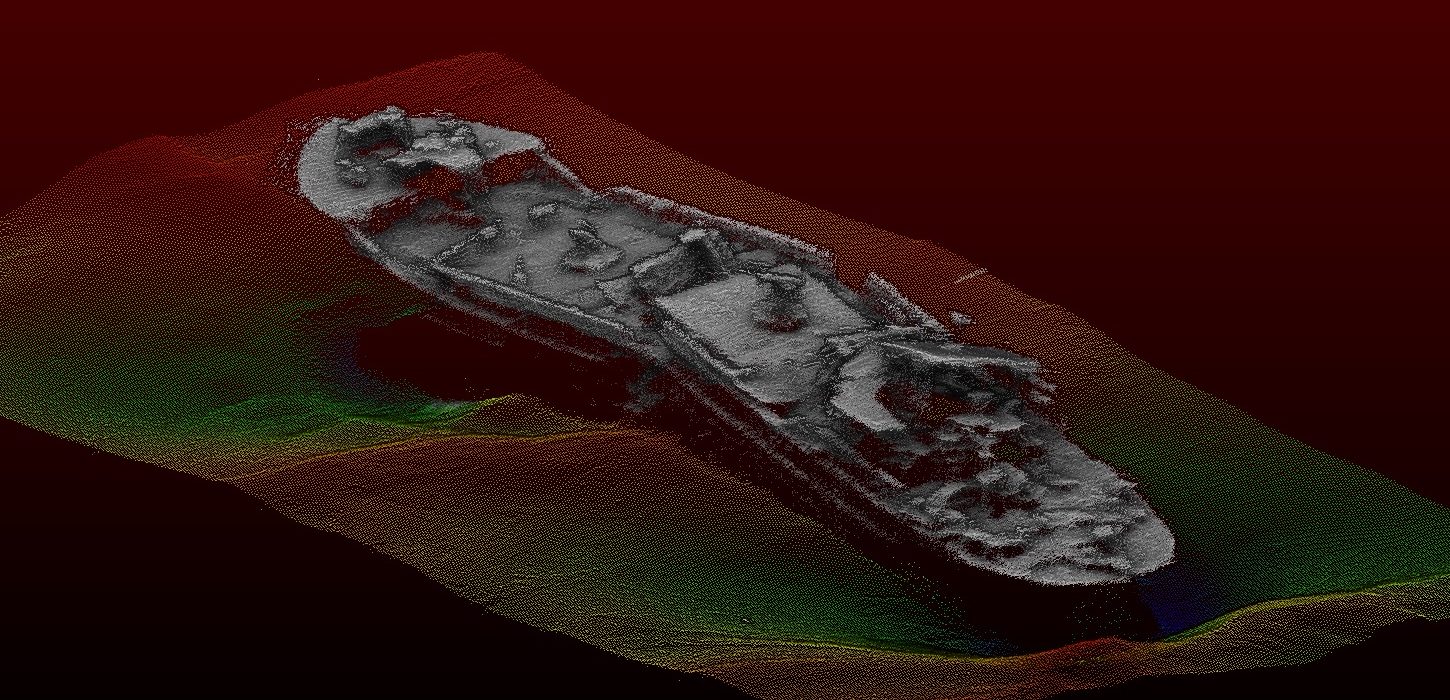
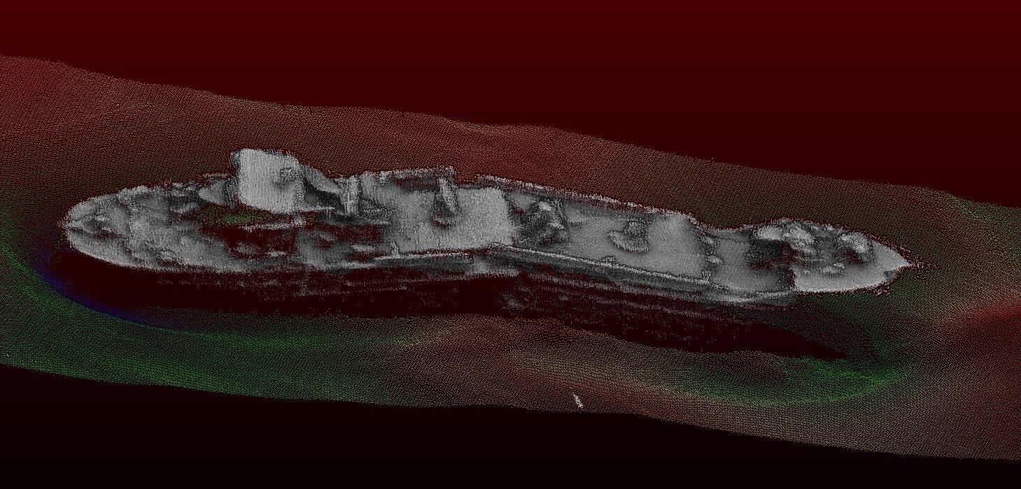
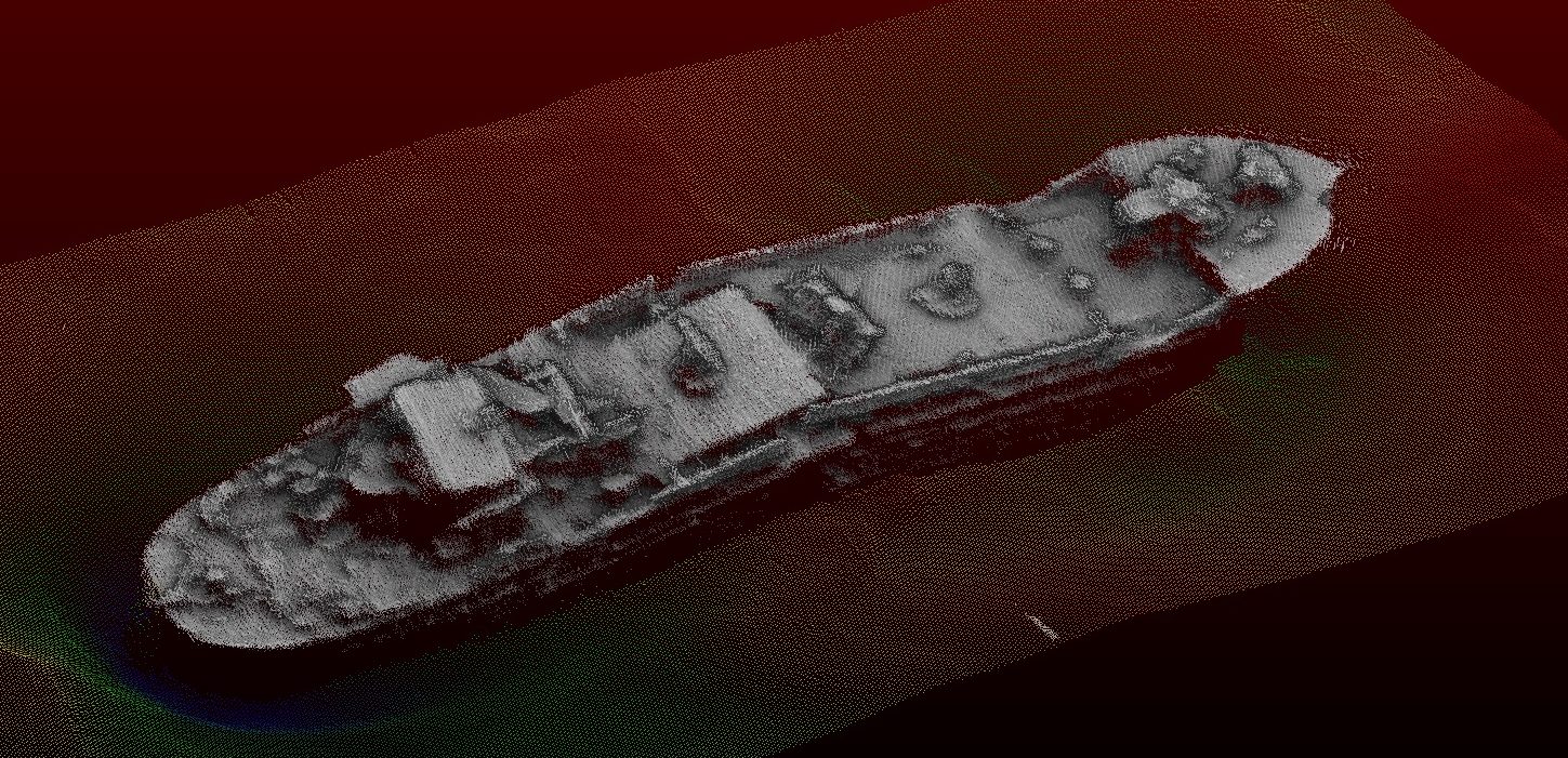
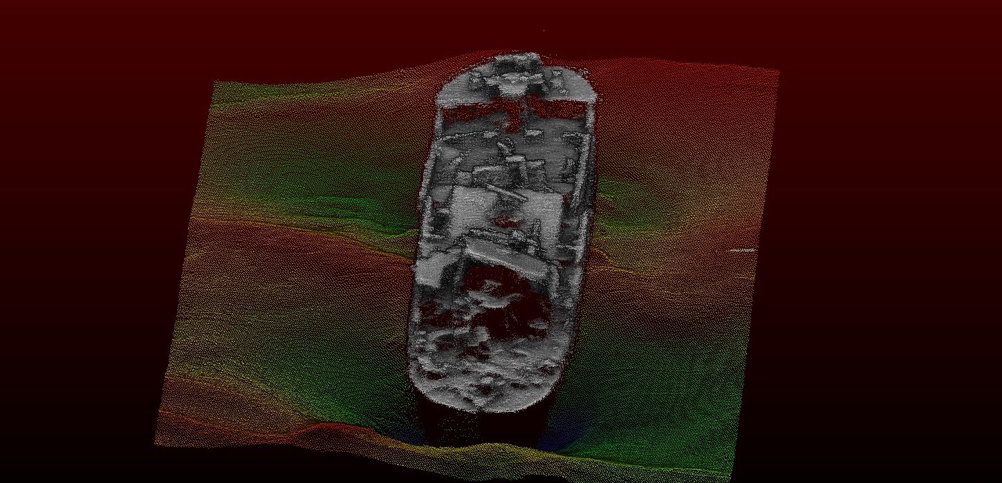
The wreck is now lying on its keel at the bottom of the Eastern Scheldt. Because of the normal effect of Dutch waters, it is in good condition and easily recognisable as a ship. For qualified divers, this is therefore an interesting dive. The Duikstichting asked Deep to make detailed measurements of the wreck so that it can be observed how a wreck develops over the course of time. The foundation also wants to perform further studies into the exact cause and impact of a rocket.
Working alongside Periplus Archeomare, specialised in archaeological research, Deep performed the measurements on the Eastern Scheldt. The Globe was measured in November with the Gemini survey vessel. Using a High Resolution Multibeam echo sounder, a detailed scan of the wreck was made.