06 Mar [:nl]PRINS HENDRIKDIJK OP TEXEL KRIJGT VERSTERKING [:en]STRENGTHENING OF THE PRINS HENDRIK DIKE IN TEXEL [:]
[:nl]De Prins Hendrikdijk op Texel, het dijkgedeelte tussen het NIOZ en Oudeschild, voldoet niet meer aan de wettelijke veiligheidseisen. De dijk wordt daarom op een unieke manier met zand versterkt. Begin oktober heeft Jan de Nul NV de opdracht gekregen om een veiligheidsdijk langs de bestaande dijk aan te brengen. Deep werd gevraagd om vóór, tijdens en na de werkzaamheden zogenaamde T0, Tx en MJO-I metingen uit te voeren. Tevens verzorgt Deep de NGE (onderzoek naar niet gesprongen explosieven) metingen voor dit project.
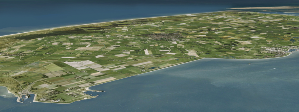
Locatieoverzicht Prins Hendrikzanddijk
Natuurlijke versterking
“De versterking van de Prins Hendrikzanddijk is het gevolg van een waterkeringscontrole in 2006, waarbij alle dijken aan de Waddenzeekant van Texel zijn afgekeurd“, vertelt Jan Fordeyn, Tehnisch Manager bij Jan de Nul NV.
Als versterking komt vóór de huidige Prins Hendrikdijk een gevarieerd zandig gebied met dynamisch karakter, passend bij het Waddengebied. Deze ‘natuurlijke’ manier van versterken zorgt ervoor dat de waterkering op de vereiste sterkte wordt gebracht en er geen landbouwgrond of gebouwen verloren gaan. Hierdoor ontstaat 200 hectare aan nieuwe natuur in het Waddengebied.
“Op dit moment worden deze dijken verhoogd en verzwaard, wat aanvankelijk ook de bedoeling was voor de Prins Hendrikdijk, todat de bewoners van Texel kwamen met het idee voor de zandige variant.” – aldus Fordeyn.
[:en]The Prins Hendrik dike at Texel, located between the NIOZ and Oudeschild, currently no longer meets the legal safety requirements. Jan de Nul NV has been awarded the contract to resolve this by Hoogheemraadschap Hollands Noorderkwartier.
Jan de Nul NV will reinforce the dike via a unique ‘natural’ method using sand, in which a safety dike, with works starting October. Deep BV has been invited to conduct the so-called T0, Tx and MJO-I surveys prior to, during and after the activities. Subsequently Deep will also conduct the relevant UXO (unexploded ordnance) surveys.
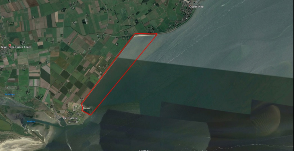
Location overview Prins Hendrik sand dike
Natural reinforcement
“The plans for the Prins Hendrik sand dike was a result of flood control assessments conducted in 2006, in which all dikes on the Wadden Sea side of Texel were rejected” – Jan Fordeyn, Technical Manager at Jan de Nul NV (note: translated from the original quote in Dutch).
As reinforcement, a dynamic nature reserve of varied sand appropriate to the Wadden region will be built in front of the current Prins Hendrik dike. This ‘natural’ method of reinforcement will ensure that the flood defense is brought to the required strength in order to protect and preserve agricultural land and buildings in the area. This reinforcement will create 200 hectares of new land in the Wadden area.
“At the moment reinforcement these dikes typically involve having them raised and weighed, which was initially also the intention for the Prins Hendrik dike up until the municipality and local inhabitants of Texel came up with the idea for the sand-based alternative.” – Jan Fordeyn, Technical Manager at Jan de Nul NV (note: translated from the original quote in Dutch).
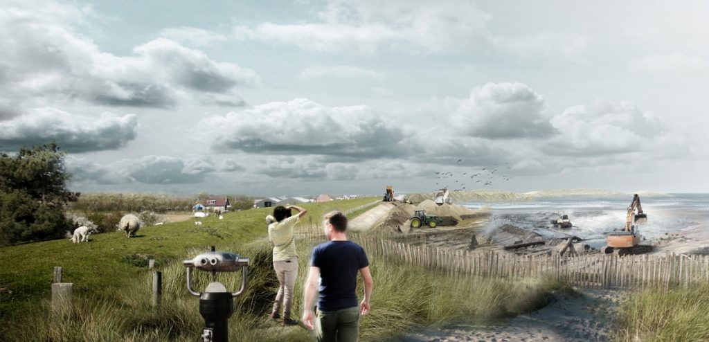
Construction Prins Hendrik sand dike, image Jan de Nul
Sand Extraction Areas
The sand that is being used for the construction is extracted from two areas in the North Sea. In the area near Den Helder, grains are extracted with which most of the dike is realized. For the outer layer, which is more exposed to waves and currents, a larger grain is used which is extracted from another site near Vlieland. At these extraction areas, Deep will carry out a T0 and UXO survey.
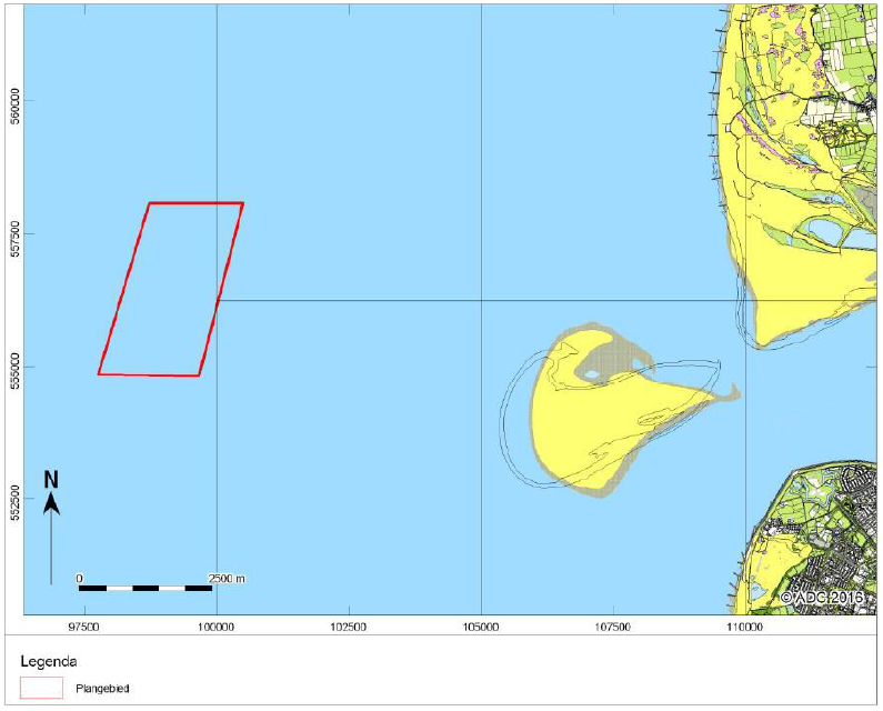
An overview map of one of the sand extraction areas, near Texel
Deep will use an R2Sonic Multibeam echosounder to measure the majority of the water depths, with shallow parts surveyed via Singlebeam echosounder.
The seabed will be investigated for magnetic anomalies via multi-magnetic sensors on a Remotely Operated Towed Vehicle (ROTV) which will consist of a multi-array of 6 G882 cesium vapor marine magnetometers. The detection is designed for tracking down 20 kg of ferromagnetic mass up to a depth of 2 meters in the seabed and tracking down 50 kg of ferromagnetic mass to a depth of 4 meters in the seabed.
In addition to this, a high-resolution side scan sonar survey will also be performed.
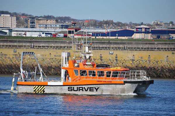
Survey boat “DEEP VOLANS” equipped with 6x Magnetometers on a ROTV
Realisation Prins Hendrik sand dike
The suction hopper dredger Bartolomeu Dias will supply the sand in the second half of 2018, after which Jan de Nul will start with the construction of the surroundings. During the realization of the Prins Hendrik sand dike, Deep will carry out seven Tx surveys, consisting of a multibeam survey of the sand extraction area supported by a UAV survey of the project area. The UAV survey is to be carried out by Skeye BV, using an unmanned aircraft to create a height model.
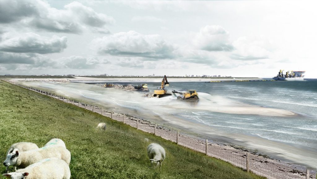
Sand reclamation Prins Hendrik dike, image Jan de Nul
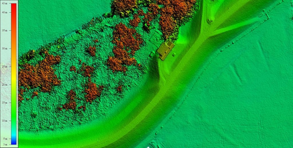
Height model made by Skeye on a dike at Wolferen
The construction deadline of the Prins Hendrik sand dike is October 2019. More information about the project can be found on www.hhnk/prinshendrikzanddijk. Follow the project on Instagram, @joel_op_de_dijk.
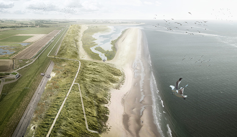
Future Prins Hendrik sand dike, image Jan de Nul
Sources:
https://www.hhnk.nl/prinshendrikzanddijk
‘Prins Hendrikdijk op Texel krijgt nieuwe veiligheidsduin én natuurgebied’
https://www.noord-holland.nl/Actueel/Archief/2017/Juni_2017/Plan_versterking_Prins_Hendrikzanddijk_Texel_goedgekeurd[:]