Survey of sheet piles in the Amsterdam-Rhine Canal
Project summary
Sheet pile walls are crucial to the infrastructure of Dutch canals. To determine in a timely manner whether they require maintenance or replacement, it's essential to continuously monitor their condition. To assess the sheet piles in the Amsterdam-Rhine Canal, Rijkswaterstaat asked us to map the situation.
PROJECT OBJECTIVES
The investigation focused on several key aspects of the sheet pile structures:
Detecting changes in depth and potential erosion near the base of the sheet pile wall.
Assessing the condition of the sheet piles, including possible tilting.
Collecting data with enough detail to distinguish individual sheet pile planks.
Delivering the measurements in a universal data format for further analysis.

COLLECTING DATA WITH MULTIBEAM ECHO SOUNDERS AND A DRONE
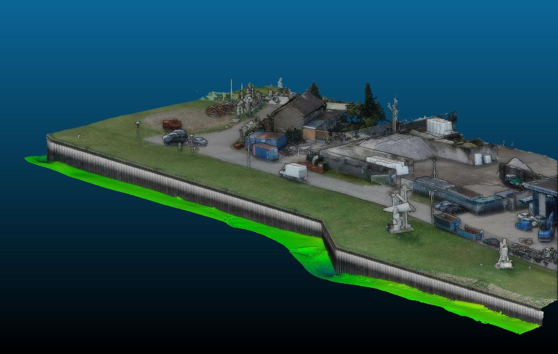
For this project, we surveyed 23 sections of the sheet pile wall, covering a total of approximately 6,500 meters. We deployed the Deep Shallow from Amsterdam. Measurements were carried out using two high-resolution R2Sonic 2024 multibeam echo sounders. The multibeam data was recorded with centimeter accuracy, supported by fiber-optic motion sensors and RTK-GPS.
Thanks to the system's high resolution and point density, even the smallest irregularities in the canal bed and sheet pile wall could be precisely documented. To optimize coverage, we mounted the multibeam transducers at a 30-degree angle, allowing measurements up to 20 centimeters below the waterline. We also used drones to capture the above-water portions of the sheet pile walls, to obtain the most complete picture of the situation possible.
DATA PROCESSING: A DETAILED VISUALIZATION
We processed the sonar data into a 3D point cloud. During processing, data from the canal bed and sheet pile walls were separated to apply specific visualization effects to each. This approach clearly highlighted both horizontal structures on the bottom and vertical details of the wall. Our processors visualized the depth information using color gradients. This made subtle structural differences and anomalies in both the wall and the canal floor more visible. For various sheet pile sections, the visualization of the bottom of the canal and the sheet pile was supplemented with the data from the drone photogrammetry.

A COST-SAVING AND SUSTAINABLE RESULT
The survey results were made available to Rijkswaterstaat through an online 3D viewer, enabling RWS and other stakeholders to closely examine the sheet pile sections in high resolution. This provided critical input for decision-making about the future of the sheet piles. After thorough analysis, RWS concluded that the service life of the structures could be extended. Thanks to timely and accurate inspections, unnecessary replacements were avoided—resulting in cost savings and promoting more sustainable infrastructure management.
